Sidebar
Table of Contents
ERASMO Project
Enhanced Receiver for AutonomouS MObility
Website: https://erasmo-gnss.eu/
Partners: Artisense, GMV, Nextium, Renault, Septentrio, VVA
Dates: June 2021 – June 2024
ERASMO is set to develop an innovative positioning On-Board-Unit (OBU) that will enable fully automated driving. The OBU will be integrating a GNSS receiver together with additional sensors to enable the target applications’ performance. To meet the required performance targets, the proposed OBU might also make use of a communication channel in order to take advantage of the cooperative positioning concept. The OBU shall optimally leverage the E-GNSS differentiators, by implementing one or several of the following technical aspects:
- Multi-constellation, multi-frequencies (E1 or E5, alternatively E1 and E6, ideally also including the E5/AltBOC wideband processing);
- High accuracy techniques (PPP, RTK or hybrid options), as well as longer integration time thanks to the use of pilot signals;
- Galileo authentication features increasing the solution trustworthiness.
The developed ERASMO receiver OBU shall be cost-efficient, and the outcome of the development shall be a close-to-market prototype(s), which corresponds to reaching a Technology Readiness Level (TRL) of at least 7. The ERASMO OBU is to provide localisation estimates for the navigation of automated vehicles with the highest level of precision, integrity, and availability, by leveraging on the information being broadcasted by the Galileo GNSS as well as the combination of absolute and relative localisation methods. Additionally, the objective will be to optimise the use of Galileo signals in terms of accuracy, integrity, correction features and availability. The OBU will allow for the possibility to hybridise GNSS data with information from multi-sensors as well as vehicle information to attain the best absolute localisation information possible, as well as to measure the level of integrity achieved. The proposed solution will allow to determine the relative localisation of the vehicle equipped with such OBU by leveraging on the perception sensors available for autonomous driving as well as a priori information stored in navigation maps. Furthermore, the project will seek to combine both relative and absolute localisation estimates to provide high accuracy and high availability localisation information for autonomous driving and other location dependent applications, including an estimate of the system integrity level.
The ERASMO project will demonstrate and measure the performance of the proposed solution experimentally in peri-urban and urban road networks and ensure that the proposed solution is economically and operationally feasible for use in passenger vehicles.
ESCAPE Project
European Safety Critical Applications Positioning Engine
Website: http://www.gnss-escape.eu/
Dates: Autumn 2016 – Autumn 2019
With connected vehicles and autonomous driving vehicles being the most relevant trend in the automotive sector there is a clear need to provide accurate and reliable positioning information for safety-critical applications. Within the context of road transportation, safety-critical applications are defined as those that possess the potential to, directly or indirectly, avoid causing harm to humans, destroying the vehicle or damaging external property or the environment. Autonomous driving, advanced driver-assistance systems (ADAS) and dangerous goods transportation are all included in this group.
The traditional way of providing the required accurate and reliable positioning information is to make use of multiple sources of sensor data. The problem with this approach is that it requires the use of such sophisticated equipment as radar/lidar-based sensor and cameras, which tend to be expensive. Furthermore, as this equipment is not specifically designed for use with automotive consumer applications, it is not fully suitable to provide reliable positioning information.
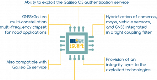
European Safety Critical Applications Positioning Engine – ESCAPE project aims to overcome these multiple challenges by developing a dedicated, reliable and accurate engine, specifically designed for automotive safety-critical applications.
The GNSS receiver in the ESCAPE engine will feature multi-constellation, multi-frequency capabilities and will be enabled to receive and process the upcoming Galileo OS authenticated signals, which is one of the key differentiators of the European GNSS, expected to be broadcast starting form 2018.
TORNADO Project
Autonomous vehicles and infrastructure interactions for mobility services in lightly populated zones
Website: https://www.tornado-mobility.com
Program: FUI
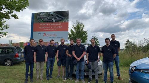
Partners: Renault, Rambouillet Territoires, BMCP, Easymile, Exoskills, Neavia Technologies, 4D-Virtualiz, IFSTTAR, INRIA Grenoble, Institut Pascal, Université de Pau et des Pays de l'Adour, Heudiasyc UMR UTC/CNRS
Dates: September 2017 – September 2020
PRETIV Project
Multimodal Perception and Reasoning for Transnational Intelligent Vehicles
Website: https://pretiv.hds.utc.fr
Dates: February 2012 – August 2015
- Development of an online multimodal perception system which incorporates vehicle localization, mapping of static objects of its environment, detecting and tracking moving objects in probabilistic frameworks through multimodal sensing data and knowledge fusion;
- Development of offline reasoning methods based on sensed data, in order to learn semantics, activity and interaction patterns (vehicle – other objects, vehicle – infrastructure), which could be injected as the contextual and country-specific a priori information to make the online perception more general for international use. This analysis aims at comparing perception methods in different traffic environments, and aims at identifying better context-specific a priori information leading to more effective perception algorithms. It includes traffic situation awareness, i.e. generation of indicators to help decision, to estimate the dangerousness of the driving situation by considering factors of sensing uncertainty and infrastructure;
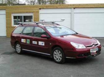
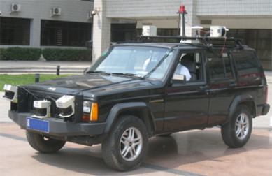
- Cross-experiments and comparative studies are to be conducted in real transnational traffic situations (France and China) by implementing the jointly developed core algorithms on two different test-bed vehicles of the partners, which will permit cross-fertilization of sensing techniques between the three research groups;
- A comparative dataset containing the experimental data, labeled training sets in typical traffic scenarios in both France and China with ground-truth, which will be used in learning country-specific traffic semantics, and will be opened to public to promote comparative researches on transnational traffic semantics and behaviors. To our knowledge, no such dataset has been proposed for international use.
PREDiMAP Project
Vehicle Perception and Reasoning Enhanced with Digital Maps
Website: https://predimap.hds.utc.fr
Program: ICT-Asia
Partners: Heudiasyc (CNRS, University of Technology of Compiègne), LIAMA, MATIS (IGN), e-Motion (INRIA), POSS (Key Lab. on Machine Perception, Peking University), Cyberc3 (Shanghai Jiao Tong University), Geoinformatics Center (Asian Institute of technology), Shiabasaki & Sekimoto lab (Center for Spatial Information Science & Institue of Industrial Science, University of Tokyo)
Dates: April 2011 – March 2013
The objective of the project is to gather research teams from China, Japan, Thailand and France with complementary skills and expertise to conduct research in the area of advanced perception systems for intelligent vehicles making a large use of digital maps. The partnership will benefit from different experiences in the fields of embedded perception systems for intelligent vehicles, digital geographic and road map information production and use, and more generally spatial information sciences. The originality of the project is to fully consider the dual concept for intelligent vehicle applications: using digital maps to perceive and using perception for mapping.


